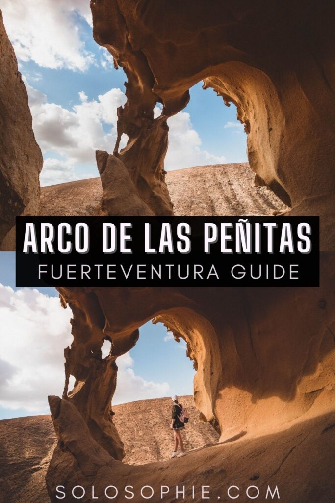
How to Visit Arco de las Peñitas, Fuerteventura
Last Updated on 16th March 2023 by Sophie Nadeau
This post may contain affiliate links. Please check out my privacy policy and disclosure for more information.
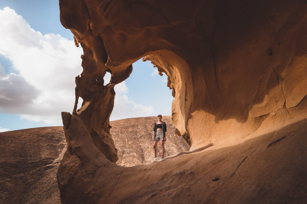
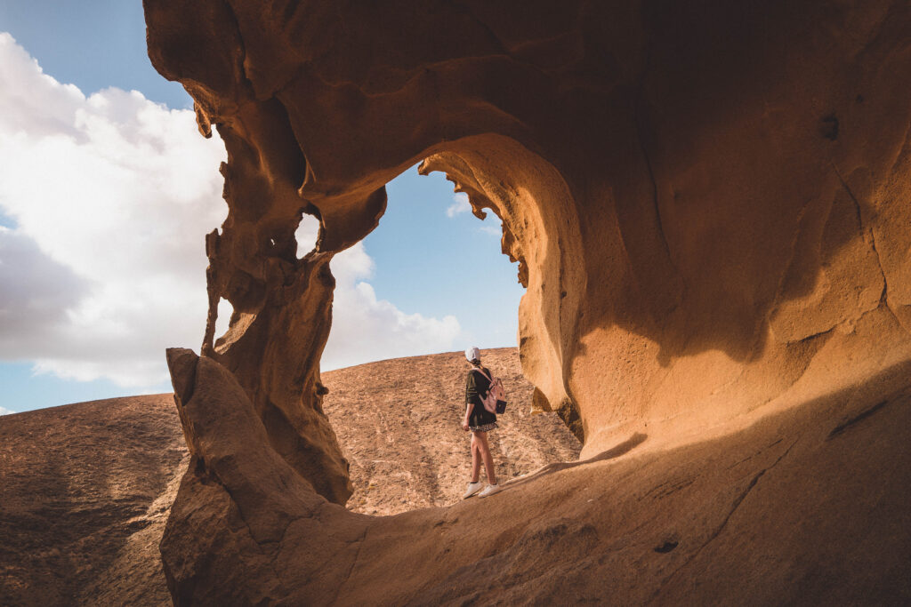
If you’ve spent any time looking at photos of unique rock formations on Fuerteventura, then no doubt you’ll have come across Arco de las Peñitas, which is located to the West of the island.
The natural archway has been carved out of the rock by the sun, wind, and rain over thousands of years and is now one of the most popular photo spots in the Canary Islands.
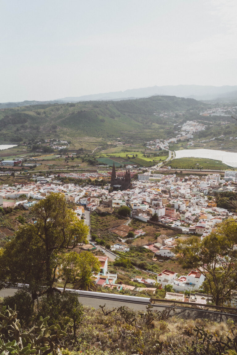
The area was also used to film some of the film Eternals. The archway is located in the Parque Rural de Betancuria, which is a short distance away from the charming Fuerteventura town and former capital of Fuerteventura, Betancuria. If you’re planning a trip to Fuerteventura, be sure to check out our perfect Fuerteventura itinerary.
If you’re planning a trip to Fuerteventura, be sure to check out our suggested 3 days in Fuerteventura itinerary.
Where is Arco de las Peñitas?
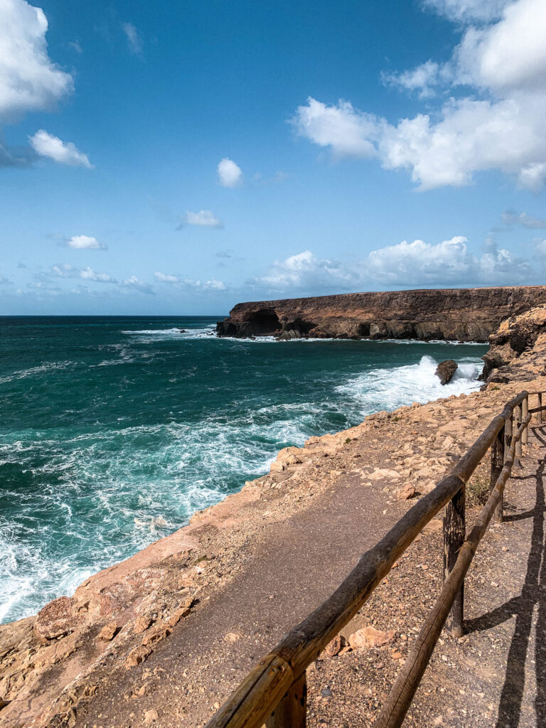
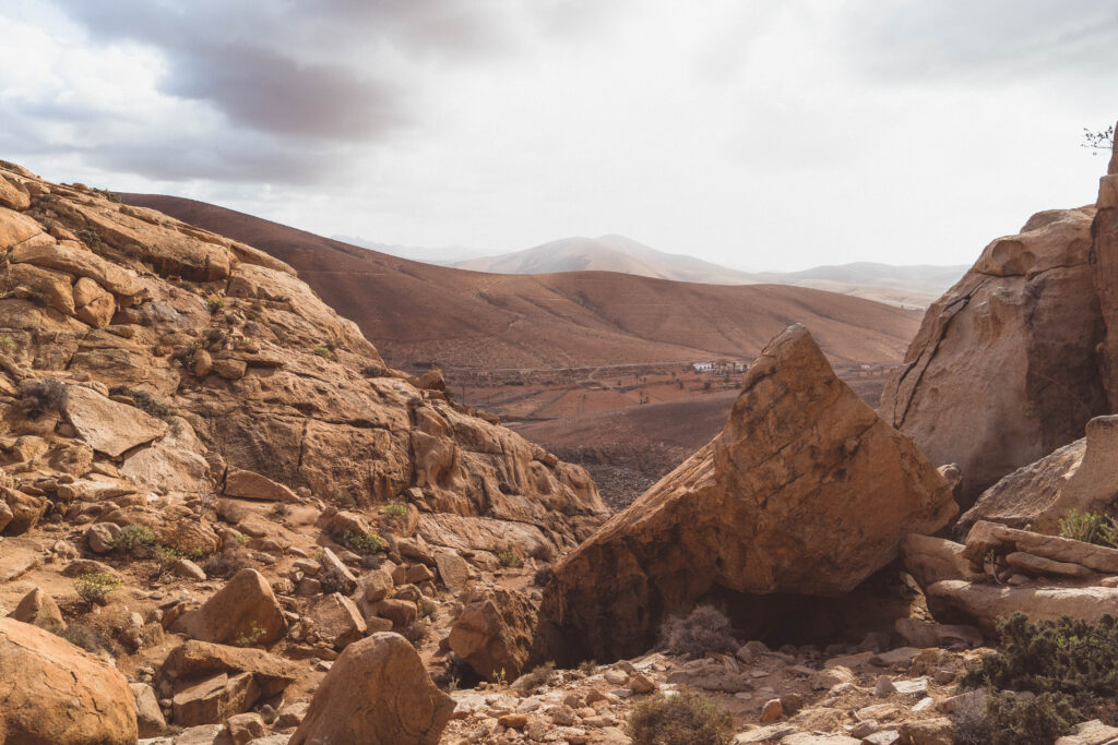
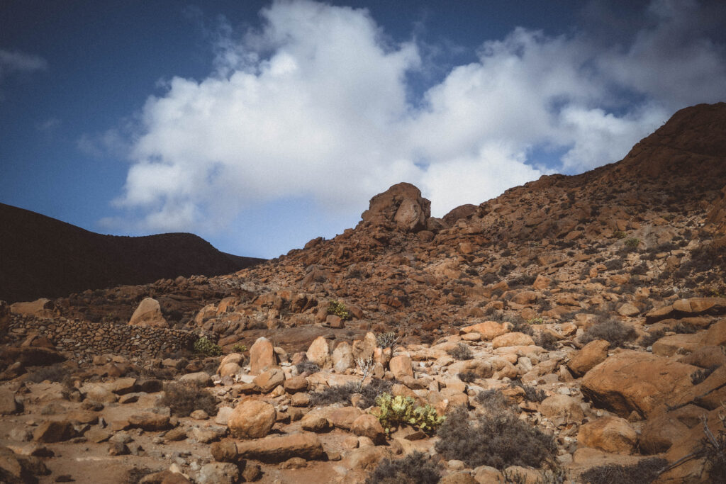
The arch is located in the Barranco de las Penitas (the ravine of the small boulders), and honestly the area is just that. Countless little boulders and unique rock formations that have been carved out of the volcanic rock by time and the elements form the lunar looking landscape.
Please note that this is one of the most difficult photo spots in Fuerteventura (particularly because I wasn’t prepared for the hike to be so steep and so had not packed suitable footwear).
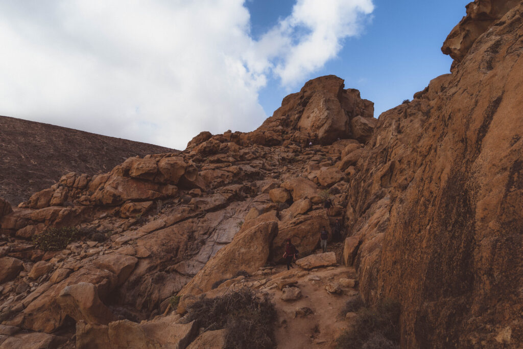
Not only is the arch hard to locate, but you have to physically climb up over rocks and over volcanic soil. A basic level of fitness is an absolute must, as is sturdy closed toe footwear.
I wore slippery tennis shoes and really struggled to get up and down the mountain slope (especially on the solid rock surfaces, which are ever so smooth). There are no facilities nearby the site so you should make sure to bring snacks and plenty of water.
I do not recommend going on this walk with small children or dogs as there are lots of steep edges and the climbing can be tough in places. As always when hiking, be sure to leave nothing but footprints and take all trash with you when you leave.

How to find the Arco de las Peñitas
If I’m honest, getting to and finding the natural stone arch is something of a nightmare on account of the fact that there are no sign posts so it’s impossible to know if you’re in the right place, you have to wander off the beaten track, and scramble over rocks to get to the arch.
It may sound like I’m complaining, or being too harsh, but I really wasn’t expecting such a difficult climb after everything I had seen and read online (to give context, my partner and I are a sporty couple in our mid twenties who love hiking) so I’d rather people were prepared before attempting this hike for themselves (and wear better shoes than me- long story short- the hike is okay, as long as you wear appropriate gear).
While there are two ways to get to the arch, I’m going to describe the shorter route, which is the one we took. You can visit the arch at the same time as the caves of Ajuy (Cuevas de Ajuy), which is one of the most popular tourist destinations on the Canary Islands.
We parked at the parking spot on Camino Pájara which is quite large and has plenty of parking spaces (please see the embedded map below). Just off from the road to Ajuy, there is another road which seemingly leads to nowhere. From there, you should take the road until it leads to a grit off road track.
You’ll then carry on down this track (we did the road in a Fiat 500, which was okay, but a sturdier car would be preferable when visiting Fuerteventura) until you reach the car park. Once at the car park, there is a clearly marked gravel path.
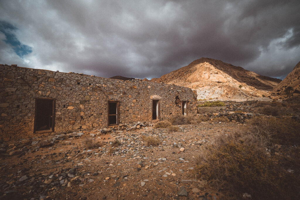
Follow the path down until you reach an abandoned building. There, the footpath veers to the right, towards the little white hermitage in the ravine. Carry on the footpath towards the left (not towards the hermitage) until you see a large boulder at the top of the hill.
The boulder is where the arch is and cannot be seen from the trail. Unfortunately, there is no clear way-marked path and so reaching the Arco de las Peñitas is a bit of a free for all. Depending on your pace, hiking up from the car park to the Arco de las Peñitas will take 30- 40 minutes.
Google maps has the correct location listed, so be sure to download the map. I personally had 4G signal the whole way so regularly checked the map to ensure that we were going in the right direction.
Once you get to the arch, there is often other people there and so be polite and wait your turn to take your photos. For even more inspiration, be sure to check out these top quotes about Spain.
Other places of natural interest in Fuerteventura include the Barranco de los Enamorados, the popcorn beach, and the Cuevas de Ajuy.
Enjoyed reading about how to visit Arco de las Peñitas? Pin this article now, read it again later: